
Welcome to the Linkinhorne Parish Council Website
Prevent wildfires. Pack a picnic, not a BBQ and help protect our green spaces. See more advice to prevent wildfires https://nfcc.org.uk/our-services/campaigns/wildfire aware/wildfire-prevention-advice/ #WildfireAware
HIGHWAYS NOTIFICATION:
Highways are in the process of closing the road near Cargibbit due to a culvert structure that has collapsed on one side of the road. As the road is narrow at this location, they are not able to keep the road open. One of the supporting beams has fallen into the river and two other beams have also moved. The structures team are working on a design and are hoping to have a team on site to undertake repairs in early September. Highways apologise for the inconvenience for local residents, but the safety of highway users must be the main priority. The diversion route will be via Pensilva and Downgate.
Road Traffic Regulation Act 1984 S.14: Temporary Prohibition of
Traffic
The below Road(s) will be temporarily closed to allow works to be
completed on the highway.
If you have any queries regarding these works please contact the Utility
direct on the number below. Any responses to this email received by
Street Works will be forwarded to the Utility for them to respond.
Please note that this is only an Intention Notice and as of yet an Order has
not been issued.
Please respond with any feedback within fourteen days from the date of this
e-mail.
Location: Road
From Access To Phoenix Farm To Junction North Of Cresta, Upton Cros
Timing: 24th August 2026 to 28th August 2026 (24 hours)
Contact: National Grid -
Tel: 0800 678 3105
Please click the following link for a map: https://one.network/?tm=GB150584699
LINKINHORNE PARISH
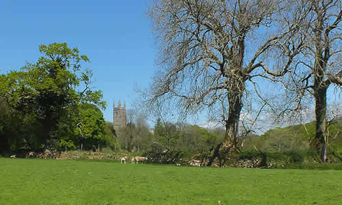
Linkinhorne, a rural parish in South East Cornwall, stretches from the River Inny in the north-east to the expanses of Bodmin Moor in the west. The River Lynher meanders across the Parish through secluded valleys and by gently rolling fields.
The three largest villages are Minions, Rilla Mill and Upton Cross; there are also the settlements of Henwood, Linkinhorne and Bray Shop as well as dozens of other small hamlets such as Caradon Town, Downgate, Ley Mill, Plushabridge, etc.
The western parts of Linkinhorne parish lie on the eastern slopes of Bodmin Moor, an area of granite moorland, rising to over 380m above sea level at Sharptor, above the Cheesewring, a granite outcrop of apparently precariously balanced rocks. The highest village in the parish is Minions, at 302m asl.
Travelling east from the Moor, the land drops to the gentler hills and river valleys which cover most of the parish. Most of this land is agricultural or woodland; the climate is mild and rarely is there prolonged cold in the winter - snow and frost rarely lasting more than a day or two.
There are no major roads in the parish. Two classified roads, the B3254, running north-south and the B3257 running northwest-southeast cross the parish, providing road links to Launceston, Liskeard and Callington.